Store Plans and Elevations
 |
| |
Converting plans and elevations into blocks
is a useful method of storing, within your file, completed items that
might otherwise clutter your screen and slow redraws and pans. Blocks
can be retrieved very simply by use of the insert command if
necessary.
The example below shows how to make the Plan and elevations into a
block called "t3":
Command: block
Block name (or ?):t3 (or your choice of name)
Insertion base point:0,0
Make a note of your block name, if not "t3". You must use the same
name if you insert the block later.
Select objects:
Select the whole plan and elevation drawing, completed in the
Documentation tutorial. Press left button and drag window, either way,
covering all the plan drawing. You may need to pan the drawing
slightly or pick some items, near the edge of the screen, to ensure
all of the drawing is selected.
In the following stages the drawing that has just disappeared will be
developed into a three dimensional model. It could be re-inserted back
onto the screen with the insert command, as described earlier,
but there is a simpler method, the oops command. This command
will restore the drawing, but unlike the u(ndo) command, which it
resembles, oops will not undo the block you have just created.
Command: oops |
Viewports and 3D Views
|
| |
| Create additonal
viewport(s) |
The next stage of the drawing will involve the creation
of three dimensional objects. It will be helpful to have at least one
view in addition to the current plan view, to help locate points and to
visibly confirm that the drawing is developing correctly.
Command: From Menu Bar select:
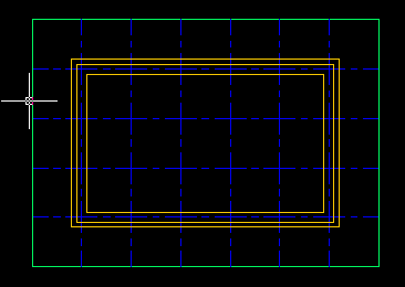
View > Tiled Viewports > Layout
These selections will cause AutoCAD to display the Tiled Viewport
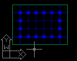
Layout dialog box. See figure, below.
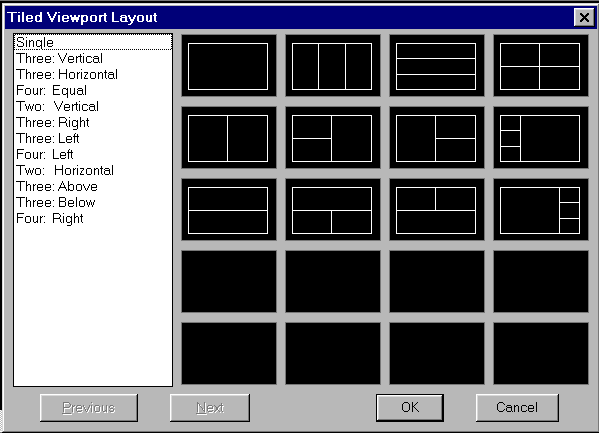
Select one of the viewport layouts by double clicking. The vertical
split screen (Two: Vertical) is recommended, but the choice is
not critical and can be changed at any time. Click OK.
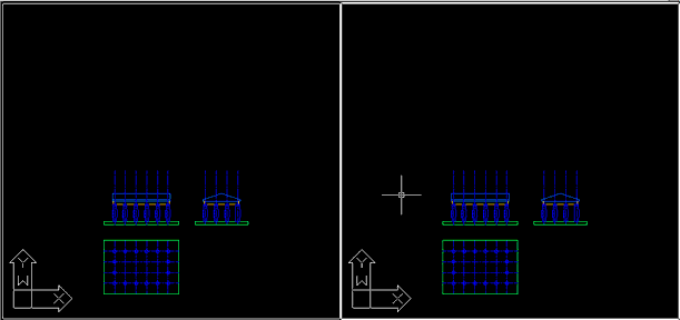
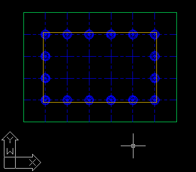
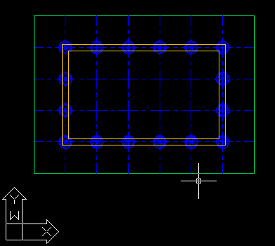
After selection, the screen will divide into the separate,
independant viewports chosen (see figure, below). Only one view, the
active view, will display cross hairs at any time. Any view may be made
active by dragging the pointer onto it and clicking with the left (or
Pick) button. When a view is active you are free to zoom, pan and edit
any part of the drawing. Any changes to the drawing will be displayed in
all views, provided that part of the drawing is visible.
|
| Change direction of one
view |
To visualise the building in 3D an oblique
view is needed, instead of the orthogonal plan and elevation views. The
following procedure is suggested.
Command: From Menu Bar select:
View > 3D Viewpoint > Tripod
This option path will display the two dynamic viewpoint screen icons,
shown below. Both icons define the intended view, and vary
simultaneously as the mouse is moved. The concentric circle indicator is
analogous to the earth, with the drawing located at the centre. The
crossed lines are the X and Y axes.
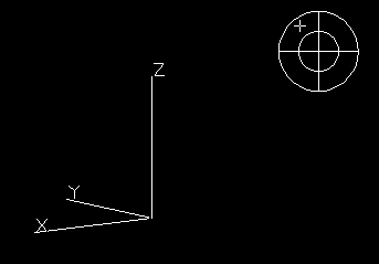
The centre of the circle represents the north pole and the outer
circle, the south pole. When the cross or cursor is aligned with the
inner circle the view will be horizontal. The view may be set by moving
the cursor within the larger circle. The effect of the changing view
location is indicated by the moving X,Y and Z axes. The selection is
completed by clicking the Pick button.
After a selection is made you are free to pan and zoom to optimise
the view. This is much easier to achieve with Ortho OFF. (Use F4) |
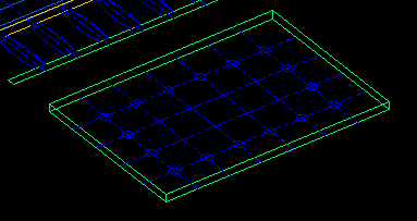
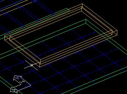
| Convert Base to 3D object |
Perimeter:
Make Floor layer current.
Method: Assume plan represents the lowest level. Copy this plan and
move it up 500mm (ie. the base thickness) to the floor level
Command: copy
Select objects:
Pick the 4 base perimeter lines only. The grid stays at the lowest
level.
Base point etc: 0,0,500
Second point:
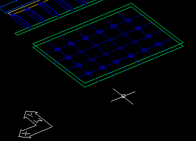
Corners:
Method: Simply connect the four top corners to their corresponding
bottom corners with lines. (ie. use the line command) Command:l
(for line)
From point: end
of
Pick top edge corner
To point: end
of
Pick bottom edge corner
See figure below.
|
| |
|
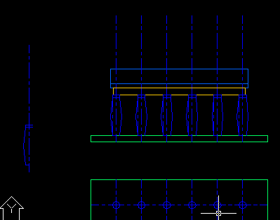
Drawing 3D Columns
|
| |
Method: Copy a column elevation profile and rotate it
360 degrees around the vertical axis. Make this into a block to replace
the existing column block. Before proceeding, make sure the current
layer is set to col. |
| Copy column from elevation |
Keep Ortho set to off, so that a copy of the
column can be freely dragged to a new position
Command: copy
Select objects:
Select from elevation drawing half of one column (one side)
including the column shaft, capital and vertical grid. Note, only one
side is needed to define the profile.
<base etc>/Multiple:
Pick any point near column
Second point:
Pick convenient point, away from the edge of the screen but clear
of both the elevation and plan.
|
| Join separate column
elements into one |
This step is not essential but simplifies the following
stages, by allowing the whole column to be developed in one process. The
polyline edit (pedit) command is used to convert the separate
column components into one polyline.
Command: pedit
Select polyline:
Pick any part of column
Object selected is not a polyline Do you want to turn it into
one?
Close/Join/Width etc: j (for join)
Select objects:
Drag window from left to right selecting all of the half column
profile, including the top and bottom edges.
Select objects: (to exit
selection)
3 segments added to polyline
Close/Join/Width etc: (to
exit)
|
|
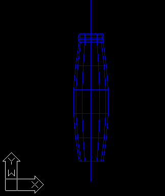
| Revolve column to make 3D
surface |
This operation uses a command for revolving
3D surfaces called revsurf. It is possible to define the number
of segments there will be in the finished surface, beforehand, by
setting what are called surftab values
Command: surftab1 ( segments in the direction
of rotation)
New value etc: 12
Column will be drawn with 12 vertical divisions, or 1 every 30
degrees around the base.
Command: surftab2 (segments along rotated
edge)
New value etc: 5
Column will be divided into 5 horizontal slices
Command: revsurf
Select path curve:
Click on the curved vertical profile of the column and capital.
Select axis of rotation:
Click on vertical column grid centre line
Start angle<0>:
Included angle etc: 360
AutoCAD will draw column after
|
| Rotate column to match
plan |
The column has been generated from the
elevation view, which has the Z axis vertical and the X and Y axes
horizontal. Since the 3D model view is based on the plan, with the Y
axis vertical, the column must be rotated 90 degrees about the X axis.
Rotation of an object about the X or Y axis is achieved via the Rotate
3d option on the Menu Bar/Modify menu.
From Menu Bar select: Modify > Operation >
Rotate 3D
Select objects:
Select column and vertical grid line
Axis by Object etc: X
Point on X axis <0,0,0>: end
of
Pick bottom end of vertical grid line
<Rotation angle>/Reference: 90
After column will flip around to plan
view
|
| Make column into block |
The columns in your plan drawing consist of
blocks, called "col" created in the first tutorial. In this next
step you update that block by replacing it with your new 3D column.
Move the pointer and Pick a window showing an oblique view, not a
plan or elevation. You will need to be able to pick the bottom end of
the column's vertical grid line. Adjust the view, and zoom nearer to the
column if necessary.
Command: block
Block name (or ?): col
Use the block name you employed previously
Block COL already exists. Redefine it? <N>y
(for yes)
Insertion base point: end
of
Pick bottom of vertical grid line
Select objects:
Select column and vertical grid line
Block COL redefined |
|
Draw Roof Beam |
| |
The beam is 600 high x 400 wide, centred on the column
grid, with bottom edge 3200 above floor Suggested Method: Offset from
the perimeter beam centreline grids to create a continuous ring of
beam.
Caution: offset is a 2D command meant for use in the plan
view. If you use it with an active oblique view AutoCAD will display a
warning. |
| Offset grid line to make
one edge |
Command: offset
O...distance: 200
Select object:
Pick a column perimeter grid line
Side to offset:
Pick one side, either inside edge or outside edge. Don't forget
which! Repeat for each of the remaining three lengths
Change layer of the newly drawn beam edges to BEAM and turn off other
layers to simplify visibility and selection.
The overshot lines at the corners are most easily cut to length by
means of the fillet command.
Command: fillet
<select first object>:
Pick beam on one side of corner
<select second object>:
Pick meeting beam
Continue until all four junctions are neatly cut
Convert beam lines to one polyline, in order to simplify the next
stages.
Command: pedit polyline edit command
Select polyline:
Pick any beam line. As entity selected is a line, prompt will query
your intentions. Respond with
Close...etc: j (ie. means join)
Select objects:
Pick other three beam lines
3 seg...etc: x ( ie. means exit) |
| Hoist beam edges to column
cap level |
Command: move
Select objects:
Select the beam polyline you have created.
Base point...: 0,0,3700
This will move object up 3700 = height plus slab thickness.
Second point: |
| Generate other edges of
beam |
Command: offset
O...distance: 400
Select objects:
Pick beam polyline
Side to offset:
Pick side of other edge. Remember the choice you made above.
|
| Copy bottom edges to make top
edges |
Command: copy
Select objects:
Pick beam polylines
Base point...: 0,0,600 (ie. move up 600)
Second point:
Draw corners of beams. Use line command in 3d view and simply
draw lines from all eight upper to corresponding lower corners (end to
end) of beams. Use int. Freezing the col layer will help
clarify situation.
The beams are now completed unless you wish to divide them into
segments.
|
Draw Roof
|
| |
Roof attributes: Roof overhangs beam 200, is 300 thick
(high) at eaves, 1500 high (overall) at ridge. Here are two suggested
methods. The first is the simplest. Use the second if you wish to extend
your skill with a more challenging exercise. |
| Alternative 1 - Use beam |
Offset beam top, outer edge, polyline to form base of
roof, then build on that. Stay in 3D viewport.
Command: offset
O...distance: 200
Select object:
Pick top outer edge of beam
Side to offset:
Pick outer side. May have to use 2D view to do this unambiguously!
Change layer of the offset polyline to ROOF. Set layer to ROOF
and turn off other layers
Copy roof edge to gutter line 300 above, and ridge line 1500 above.
Command: copy
Select object:
Pick roof edge
<Base../multiple: m (for multiple)
Base point...: 0,0,0
Second point...: 0,0,300
Second point...: 0,0,1500
Second point...:
Draw gable end:
use line command drawing from end of roof at gutter to centre
at ridge level. Draw ridge line from end to end. Delete/trim unnecessary
construction lines/plines. Explode plines as required. Freeze beam
layer.

|
| Alternative 2 - Use
elevations |
Copy roof elements from the elevation drawings and use
them to construct the roof model which can then be moved to its correct
position. You will need to create corresponding insertion points in the
roof model and the building in order to locate the completed roof. |
| Model Display |
Devise and implement a method of titling your 3D model,
as a total display. Options you might consider are; creating a simple 3D
title block, that can be moved or rotated, or editing and rotating the
2D border and title block from Tutorial 3.
Now that you have a model you no longer need the remains of the
drawing completed back in Tutorial 3. Delete the elevations, grid lines
and any other clutter you might have created getting to this point. |
3D
Surfaces
|
| |
You may reduce the number of viewports to one at this
stage, if you prefer, as the plan view will no longer be required. The
preferred viewport should be made active (ie.click in it) before
reverting to one, by means of the menubar View
> Tiled Viewports> Layout...
AutoCAD produces solid views of 3D wire frame objects by means of its
hide and shade commands which eliminate elements that lie
behind object surfaces.
The revsurf command used to construct the 3D columns in
Tutorial 4 is, as its name suggests, a surface command. However the
plane shapes, such as the roof and floor, have been constructed in the
wire frame model by drawing their edges. No surfaces have been defined.
To utilise hide and shade commands it is necessary to define plane
surfaces using the 3dface command. Surfaces are defined by
selecting their corners. For rectangular figures corners should be
selected by proceeding either constantly clockwise or constantly
anticlockwise. For polygons it is necessary to proceed as shown below. |
| Define Floor Surfaces |
The floor consists of 5 rectangles (1 top + 4 sides)
Each needs to be defined as a 3D surface. There is no need to define the
bottom of the floor slab. |
| Add floor surface layer |
Before the next command it is suggested that you turn
off irrelevant layers and create a layer called floor-surf to
distinguish what you are about to draw from the existing slab edge
drawing.
Command: ddlmodes
Command displays Layer & Linetype properties dialog box.
- To turn off unwanted layers Select unwanted layers, then Off
- To create new layer. Select New button. Type floor-surf
. Select floor-surf layer from list. Click colour square.
Choose a colour then OK
Later in this tutorial you will be required to create two other
layers, beam-surf and roof-surf. It may be convenient to
do that now, while the method is fresh in your mind. |
| Define Slab Floor Surface |
Work in the 3D viewport to ensure top face is selected.
Command: 3dface
First point: int
of
Pick a corner
Second point: int
of
Pick an adjacent corner.
Line between the selected points will change colour after the second
point is picked
Third point: int
of
Pick next corner, continuing in the same direction. As with the
previous step, the line joining the points will change colour.
Fourth point: int
of
Pick fourth corner
With this selection the line joining the points picked and the fourth
line, completing the rectangle, will both change.
Third point: (to complete
the command) |
| Define Sides of Slab |
The four vertical sides of the slab each need to be
defined in the same manner as the top. To do this repeat the commands in
Define Slab Floor Surface for each side. Provided you are able to
pick each corner without error, there is no need to rotate your view, to
select the far sides of the slab. In other words, you can define a
3dface from the front or the back of the surface.
Command: qsave |
| Define Other Surfaces -- (i)
Beam |
The beam is a complex object athough only the sides are
visible from most angles. The method of defining the beam side surfaces
is identical to that used to define the slab edge surfaces. First create
a new layer, called beam-surf, and use this layer to define the
beam outside surfaces.
Should you intend to view the building from down low, at close range,
you will also need to define the under surface of the beam, and perhaps
inside surfaces as well. You could treat each length of the beam as a
separate rectangle. Several options are suitable for treatment of the
corners. This refinement, which is entirely optional, could be added now
or later. |
| (ii) Roof and Gable |
The roof consists of four rectangles (2 fascias along
the long sides plus 2 roof planes) and 2 x 5 sided gable ends. The
rectangles may be defined in the same manner as the other rectangles
above. The roof surfaces should be drawn with their own unique layer,
called "roof-surf". Make this layer now, before drawing the roof
surface, if you have not already done so.
Command: qsave |
| Hide Command |
Once the surfaces have been defined, hiding unwanted
lines is simply a matter of one command.
Command: hide
The hide command regenerates the drawing, while suppressing
the hidden lines. The command must be repeated whenever a view is
changed, as the viewpoint returns to normal (wire frame mode) each time.
Try this command initially to check your success in defining the
3dfaces. If necessary enter additional 3dface commands for undefined
surfaces. Turning off layers, other than those showing surfaces, may be
a useful action during this checking process. |
Dynamic Viewing
|
| |
AutoCAD's dynamic view command (dview ) provides
a powerful, method of displaying 3D objects, based on a camera and
target metaphor. Choices within the command are made by entering values
or by using slider bars. Experiment with the command and its options for
a few minutes before you settle on a particular view.
Command: dview
Select objects:
Try both of the following methods:
1. Select part, or all, of your model and select dview options to
create an ideal view.
AND
2. Enter instead of selecting the model.
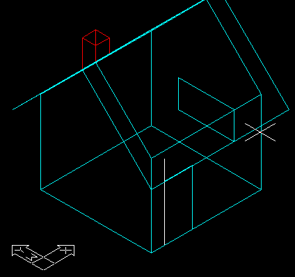
With this option AutoCAD provides a simplified 3D house instead of your
model. Once you have finalised options, and ed, your model will be
redisplayed.
This second method offers significant speed advantages if a model is
complex, and your computer is slow, as the 3D house redraws very
quickly. On entering the dview command environment you will be presented
with the following command options. As each is selected, by keying the
upper case option ID, (shown in bold text) AutoCAD will modify the view
and redisplay the command options, repeatedly until you exit dview.
CAmera/TArget/Distance/Points/Pan/Zoom etc:
Experiment first with the CAmera and TArget options.
These are varied by moving slider bars.
- CA CAmera —Orbits the camera (or the point from which you
are looking) around the target point.
- TA TArget —Rotates the target point (the point you are
looking at), around the camera. At first you may encounter some
surprising results, such as images expanding beyond the screen or
disappearing altogether. Simple errors can be corrected by the undo
command. Total disasters can be overcome by exiting and re- entering
dview. Note that you can always get back to the plan view (after
exiting dview) by entering plan at the Command prompt, and
entering w (for World coordinates)
Only after gaining some familiarity with CAmera and TArget, should
you experiment with the next option, Distance.
- D Distance— Refers to the distance between camera and
target. You will find this feature more subtle than CAmera or TArget,
and perhaps frustrating at first, because entering a Distance value
also activates perspective mode. It is most important that you "prime"
the slider bar initially, and set a workable initial distance value of
(say) 20000, after you key D for the first time. When you wish to vary
distance later, including reducing it to show internal views, the
slider bar will be effective.
- PO POints— Allows you to specify the exact locations of
camera and target. This option is especially useful for setting up a
series of accurately positioned serial views. eg. when making a
virtual movie.
- PA PAn —Shifts the image without magnificaton or change to
the Distance.
- Z Zoom —Provides a Zoom/Centre function and, when
perspective mode is on, enables the lens length to be adjusted.(eg.
wide angle to telephoto)
- TW TWist— Permits rotation of the view about the line of
sight. Measurement is similar to AutoCAD angular measurement
generally. ( ie. anticlockwise from 3 o'clock )
- CL CLip —Enables unwanted objects at edges to be eliminated
from view.
- H Hide— Performs hidden line suppression on the view.
- O Off— Turns off the perspective view, when necessary. (eg.
when control is lost)
- U Undo— Reverses the effect of the previous dview
operation. (eg. if something goes wrong)
- X Ends— the dview command and causes AutoCAD to
regenerate the selected view of the model.
Once you have gained some familiarity with the dview controls, settle
on a suitable view, using the methods you are most comfortable with,
eXit dview, and proceed to the next section. |
Shades, slides & plots
|
| Making a shaded view |
The shade command is a development of the hide
command, with the addition of shading of surfaces, based on the surface
layers and colours chosen. There are no provisions for lighting and
shadows or any other shade options in standard AutoCAD R14. Proceed as
follows.
Command: shade
The shade command, like hide, needs to be entered each
time a view is changed. |
| Making slides |
AutoCAD is unable to plot shaded images but can store
them as slides. Making a slide file is very simple to achieve. When you
have a shaded view that you wish to keep, proceed as follows.
Command: mslide
Type the slide file name in the Create Slide File dialog box.
Amend path if you wish to store slide files in a special directory. |
| Viewing a slide file |
Proceed as follows.
Command: vslide
Select a slide from Select Slide File dialog box. |
| |
Completion of Temple Tutorial
|
| |
That's all for now. Save your drawing (if you haven't
already) and then exit AutoCAD:
Command: end (to save and exit)
Remember to log off before leaving. |